
🗺️ Cayman Islands government unveils interactive shoreline map
🏖️ The tool highlights public beach access points but also reveals limited access in some areas

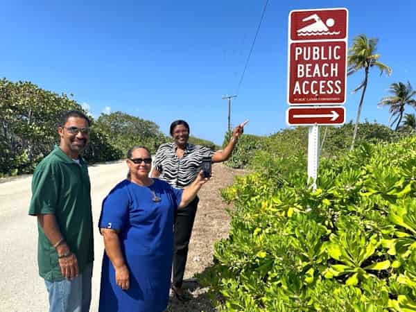
The Cayman Islands government has launched a Shoreline Interactive Map (IMAP) that identifies public pedestrian pathways to the shoreline and public beach areas across the three islands. The map, which includes information about each spot in pop-up boxes, also highlights the limited public access to beaches on Grand Cayman. Despite featuring around 300 points, there are long stretches of the coast with no official public access. The map is now live on the Public Lands Commission’s website. 🏝️
Beach access has become a contentious issue on Grand Cayman, with development over the past two decades leading to access being curtailed or lost entirely. Some access points were lost due to agreements with previous governments, while others disappeared due to approved developments. In some cases, landowners have blocked public access points, leading to concerns that beach access could eventually become a paid service. The Shoreline IMAP is part of a broader project to address this issue, with a standalone smartphone app planned for next year. 📱
The map's launch will be supported by a six-month public engagement campaign, led by the Public Lands Inspectorate, which is responsible for enforcing laws relating to the use of public lands. The government is encouraging the public to use the tool and provide feedback to help with the development of the project's next phase. The IMAP includes features such as real-time user insights through Google Analytics and opportunities for public feedback through online surveys. The public is also being asked to report blocked shoreline access points directly to the Public Lands Inspectorate. 📝


