
🚧 Cayman Islands government chooses undisclosed route for East-West Arterial Road extension
Environmental activists express concern over potential environmental impact and call for transparency

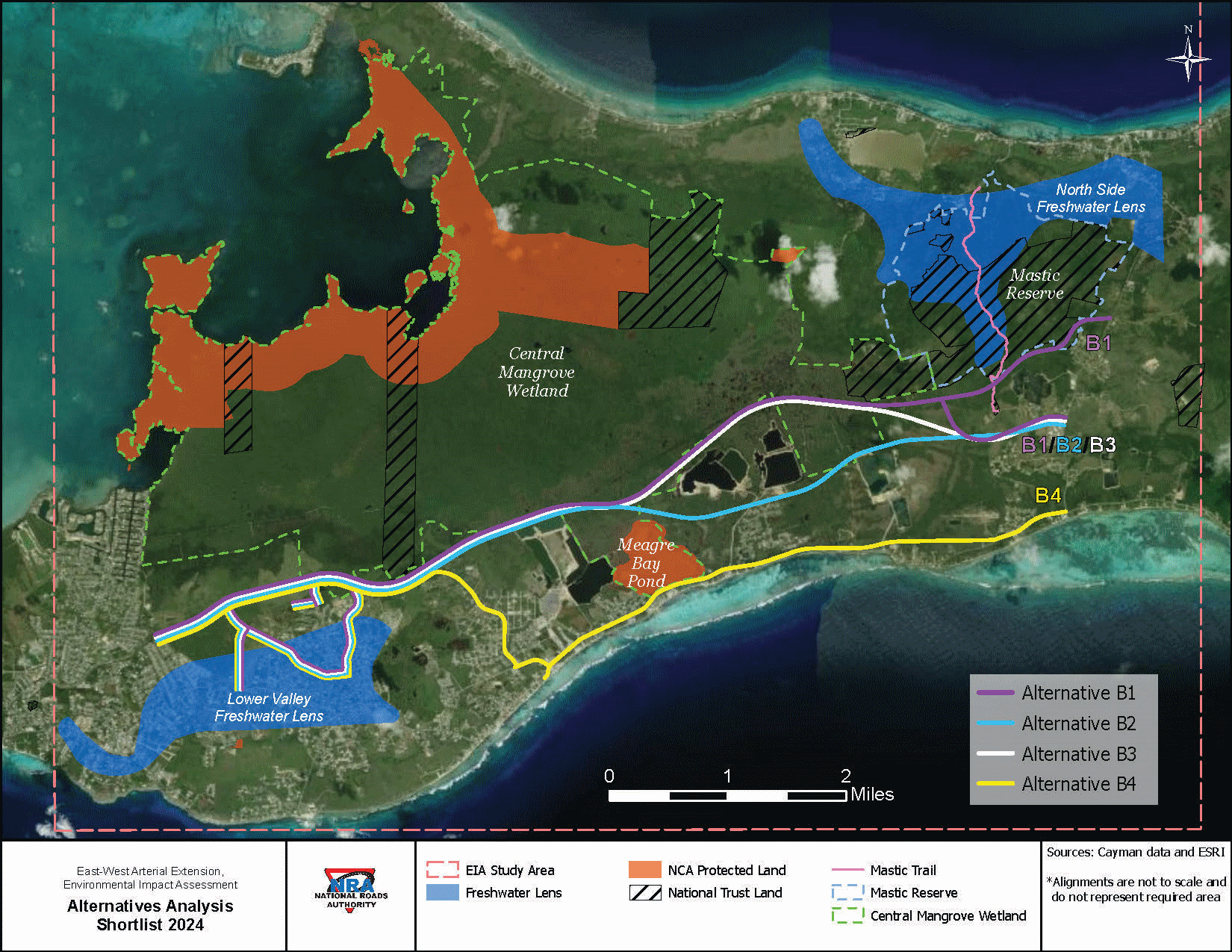
The Cayman Islands Cabinet has approved a route for the East-West Arterial Road extension, based on a draft environmental impact assessment (EIA). The selected route, which runs from Newlands to Frank Sound, has not yet been disclosed to the public, sparking concerns among environmental activists. The government's choice is suspected to be the original route, excluding the northern branch through the Mastic area. However, environmental campaigners believe a more sustainable, cheaper, and safer alternative, known as route B2, has been overlooked. 🛣️
Local environmental activist group, Sustainable Cayman, has urged the government to reconsider its choice and opt for route B2, which they claim will have less impact on the Central Mangrove Wetlands. The group also called for decision-making based on expert scientific advice. Despite these appeals, the government appears to have chosen a route that could potentially open up more of the wetland for development, a move that activists warn could be detrimental to the largest contiguous wetland habitat in the Caribbean. Critics argue that the real motive behind the road extension is to open up land for development, rather than resolving traffic congestion. 🌿
Many believe that implementing a modern, safe, reliable public transport system, mandating school buses for private schools, encouraging flexible working hours, and decentralising government offices would be more effective in managing traffic between George Town and the Eastern Districts. The government's decision to choose a route that is potentially more expensive, longer, less safe, and more environmentally damaging, has added to public mistrust. 🚍


